If you are weighing up a Wigram commute Christchurch lifestyle, the short answer is that Wigram is one of the more practical south-west suburbs for getting across the city. As at June 2026, typical off-peak driving from central Wigram to the Christchurch CBD is about 15 to 20 minutes, with peak-hour trips often closer to 25 to 35 minutes depending on Brougham Street, Moorhouse Avenue, and inner-city parking.
Wigram also has useful bus coverage, a direct major cycleway connection, and quick road links to Riccarton, Hornby, the airport, Christchurch Hospital, and the University of Canterbury. The exact time will depend on where you start in Wigram, especially whether you are closer to The Landing, Corsair Drive, Awatea Road, or Springs Road.
Quick answers: drive times to CBD, airport, hospital, university
Typical drive times from Wigram
These are realistic planning ranges for everyday trips, as at June 2026. They assume a start point around The Landing or central Wigram Skies, not the outer edges of the suburb.
- Wigram to CBD: about 15 to 20 minutes off-peak, or 25 to 35 minutes in peak traffic.
- Wigram to Christchurch Airport: about 12 to 18 minutes off-peak, or 18 to 28 minutes at busy times.
- Wigram to Christchurch Hospital: about 13 to 18 minutes off-peak, or 20 to 30 minutes in peak traffic.
- Wigram to University of Canterbury: about 10 to 15 minutes off-peak, or 15 to 25 minutes in peak traffic.
- Wigram to Westfield Riccarton: about 10 to 15 minutes off-peak, or 15 to 25 minutes in peak traffic.
- Wigram to Hornby: about 5 to 10 minutes for The Hub Hornby and surrounding shops.
The Wigram to CBD route is short in kilometres, but it crosses some of Christchurch’s busier commuter roads. That is why the difference between a 10.30am trip and an 8.15am trip can be significant.
By car: routes and peak-hour realism
The main CBD routes
Most drivers heading from Wigram to the city use one of three broad options. The first is via Curletts Road, the Christchurch Southern Motorway, Brougham Street, and then Moorhouse Avenue. This is often the simplest route for the eastern side of the CBD, the hospital area, and Ara.
The second common option is via Wigram Road, Matipo Street, Blenheim Road, and Riccarton Avenue. This can work well if you are heading to Christchurch Hospital, Hagley Park, or the western side of the central city. The third option is via Magdala Place and Lincoln Road, which can suit Addington, Sydenham, and parts of the south CBD.
The NZ Transport Agency Waka Kotahi notes that the Christchurch Southern Corridor was designed to improve travel times and reliability for traffic heading to the Christchurch Central City and Lyttelton Port from the south. For Wigram residents, the important practical point is that Curletts Road gives quick access to this state highway network.
Where the delays usually happen
The drive is rarely difficult, but it is not always fast. Peak delays tend to build around Brougham Street, Lincoln Road, Moorhouse Avenue, Riccarton Road, and hospital parking. School drop-off traffic can also affect local streets around Wigram, Aidanfield, Sockburn, and Riccarton.
If you are working in the CBD and need a reliable arrival time, allow 30 to 40 minutes door to desk during the morning peak once parking and the final walk are included. If you are driving outside peak times, the trip is often closer to 15 to 20 minutes to the edge of the CBD.
Airport access
For Wigram to Christchurch airport, most drivers head through Hornby, Russley, or Avonhead depending on traffic. The airport is close enough for regular work trips, early flights, or family pickups, but Russley Road and Memorial Avenue can be slower around commuter peaks and holiday travel periods.
By bus: Metro routes serving Wigram
Route 60: Wigram to the Bus Interchange
Wigram has several Metro services either through the suburb or close to its edges. For a city trip, the most direct option for many residents is Route 60, which runs from Wigram through Aidanfield, Hillmorton, Barrington, Christchurch Hospital, and the Bus Interchange before continuing east. According to Metro Christchurch timetables, Route 60 serves Corsair Drive and The Landing.
As at June 2026, a weekday Route 60 trip from Corsair Drive at The Landing to the Bus Interchange is typically about 30 to 35 minutes on the timetable, depending on the time of day. The same route also gives a useful public transport link to Christchurch Hospital.
Route 100: Wigram, university, Riccarton, Merivale
Route 100 is useful if your regular trip is not the CBD. It runs from Halswell and Wigram to The Palms via the University of Canterbury, Westfield Riccarton, and Merivale. On the timetable, The Runway near Kittyhawk Avenue to the University of Canterbury is usually about 12 to 18 minutes, with Westfield Riccarton a few minutes further on.
This matters for households with students, university staff, or people working in Riccarton and Merivale. It also gives Wigram residents a bus option for shopping and appointments without needing to drive across town.
Other nearby services
Route 80 runs between Lincoln and Parklands via Prebbleton, Riccarton, Christchurch Hospital, and the Bus Interchange, with stops near Blenheim Road and Curletts Road. Route 125 links Halswell and Westlake with Redwood via The Hub Hornby, Russley, Christchurch International Airport, Bishopdale, and Northlands. These routes are more useful if you live close to the relevant edge of Wigram or can walk, bike, or be dropped at a nearby stop.
For day-to-day planning, use Metro’s live tools before leaving. Timetables are helpful, but roadworks, detours, events, and school-term traffic can change the real trip time.
By bike: Little River Link
A direct cycleway connection
Wigram’s strongest active transport feature is the Little River Link, also known as Puari ki Wairewa. Christchurch City Council describes it as a major cycleway connecting Wigram, Sockburn, Middleton, and Addington to the Central City. It also connects toward the Little River Rail Trail for longer recreational rides. You can check the wider network on the Christchurch City Council bike map.
For confident riders, Wigram to the central city by bike is a realistic commute rather than a weekend-only idea. A typical ride from central Wigram to the CBD is roughly 25 to 40 minutes, depending on fitness, exact start point, wind, and how many road crossings you hit.
Who it suits
The cycleway is especially useful for people working around Addington, Hagley Park, the hospital, Ara, or the west side of the CBD. It can also help families build shorter local trips by bike, including rides to shops, parks, and nearby activities.
Christchurch weather is usually the deciding factor. A nor’wester, winter rain, or a dark evening ride can change how attractive the bike feels. Secure bike parking at your workplace matters too.
Why Wigram’s connectivity drives demand
Useful access in several directions
Wigram’s appeal is not based on one single commute. It works because it gives reasonable access in several directions: the CBD to the east, Hornby and Rolleston to the west, Riccarton and the university to the north, and Halswell to the south. That spread is useful for households where two adults work in different parts of Christchurch.
This is one reason demand for new homes in Wigram has stayed steady. Buyers are not only comparing floor plans and section sizes. They are also thinking about school runs, work trips, airport access, weekend sport, and how often they can avoid crossing the whole city.
Everyday amenities reduce extra trips
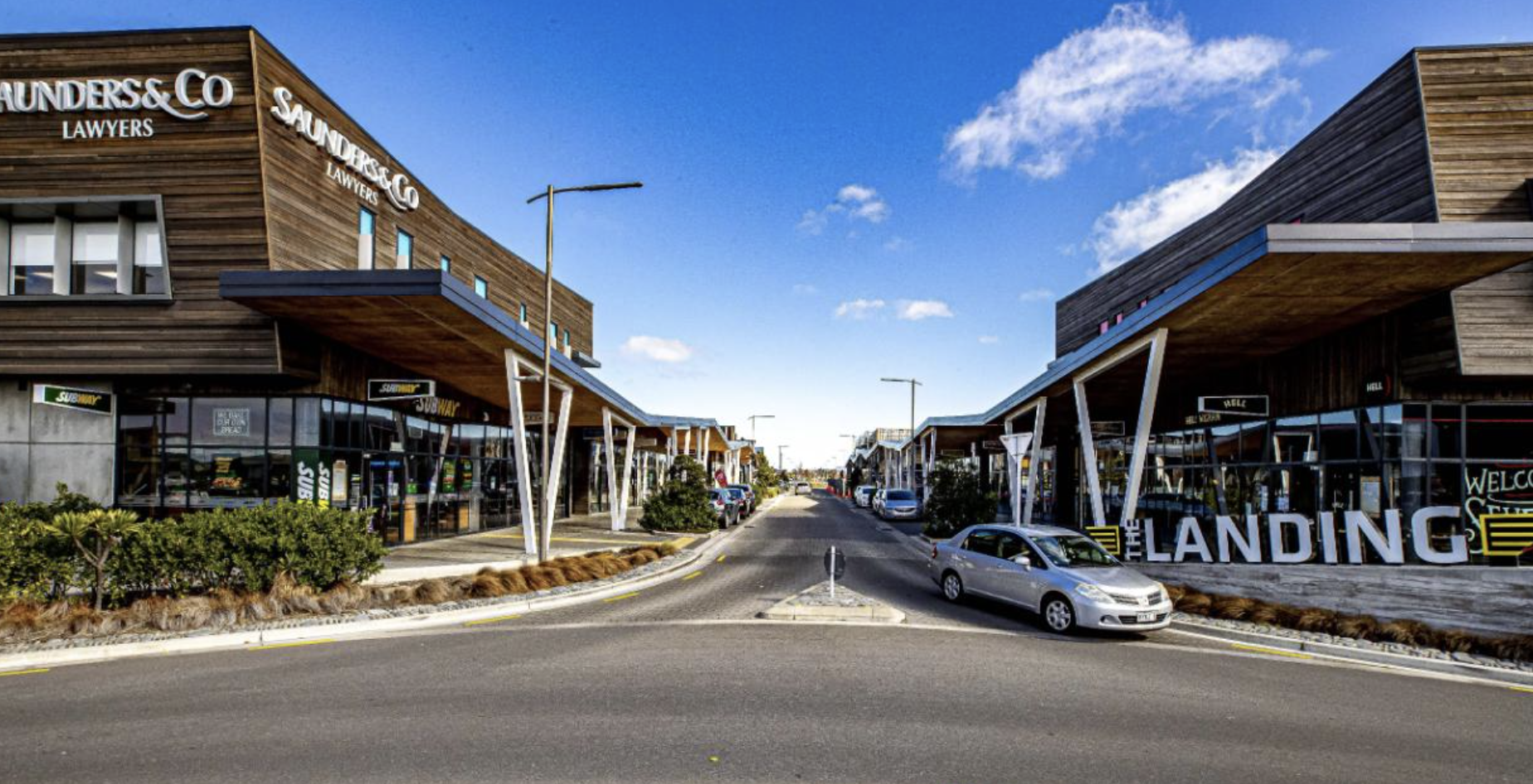
The Landing gives Wigram residents local access to a supermarket, food, services, and hospitality. Hornby, Riccarton, and Halswell add larger retail options within a short drive. Ngā Puna Wai is also close for sport and recreation.
Families often look at transport alongside education, especially if they are comparing Wigram with Halswell, Rolleston, or Lincoln. If that is part of your decision, it is worth reading about schools in Wigram as well as checking the actual morning travel time from the street you are considering.
The trade-off
The trade-off is that Wigram is still a car-friendly suburb. Public transport is useful, and the Little River Link is a genuine asset, but many households will still use a car for work, sport, groceries, and weekend trips. If you want a one-seat bus trip to every destination, Wigram will not offer that. If you want a suburb with good road links, a practical CBD commute, local shops, and multiple transport choices, it is a strong option.
Frequently Asked Questions
How long does it take to drive from Wigram to Christchurch CBD?
As at June 2026, allow about 15 to 20 minutes off-peak from central Wigram to the edge of the Christchurch CBD. During the morning or evening peak, a more realistic planning range is 25 to 35 minutes, especially if your route uses Brougham Street, Lincoln Road, Moorhouse Avenue, or Riccarton Avenue. Add extra time for finding a park and walking to your workplace.
How far is Wigram from the airport?
Wigram is roughly 8 to 10 kilometres from Christchurch International Airport, depending on your exact starting point and route. By car, that is usually about 12 to 18 minutes off-peak. At busier times, allow about 18 to 28 minutes because Russley Road, Memorial Avenue, and airport approach roads can slow down. Route 125 can also be useful from nearby stops for airport trips.
Which bus goes from Wigram to the city?
Route 60 is the main Metro bus for many Wigram to city trips. It runs from Wigram through Aidanfield, Hillmorton, Barrington, Christchurch Hospital, and the Bus Interchange. As at June 2026, timetable travel from Corsair Drive at The Landing to the Bus Interchange is typically around 30 to 35 minutes. Route 100 is better for the University of Canterbury, Riccarton, and Merivale.
Is Wigram bike-friendly?
Yes, Wigram is reasonably bike-friendly by Christchurch standards, mainly because of the Little River Link cycleway. This route connects Wigram with Sockburn, Middleton, Addington, and the Central City. A typical ride from central Wigram to the CBD is about 25 to 40 minutes, depending on your pace, weather, and final destination. Local riding conditions still vary by street, so test the route before relying on it daily.